Hydrographic Surveyors
Advertisement
Developers' Tools v.1.0.0100
Developers' Tools® 4Xpert... It is an integrated application to AutoCAD®, which turns it to a powerful tool for the Surveyors, Engineers, and Architects.
Advertisement
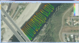
Eye4Software Hydromagic v.7.0.15.929
Hydrographic Survey Software for Windows, Load topographic or nautical maps, create singlebeam soundings, generate DTM's (Digital Terrain Models), generate depth contours, generate cross-sections, volume calculations and more.
Copan Lite v.11 11
Land surveyors and civil engineers: o Calculate surveys and manage points, effortlessly o Run Copan on Windows 2K/XP/Vista/7 o Use it forever and pay nothing o Choose quadrant bearings or N/S azimuths, and gons or DMS o Create point files
Marine Software Suite v.1.00
Marine Software Suite is a user-friendly Draught Survey, Lashing Calc and Marine Navigator software for Marine Surveyors and Ships Officers. Marine Software Suite is easily operated using either mouse or keyboard.
Marine Software Bundle v.4.0
Marine Software Bundle is a user-friendly Draught Survey calculation software for Ships' Officers and Marine Surveyors. It is easily operated using either Keyboard or Mouse.

Marine Software Bundle 2007
Draft Survey and Lashing calculations. Marine Software Bundle is a user-friendly Draught Survey calculation program for Ships' Officers and Marine Surveyors. It is easily operated using either Keyboard or Mouse. Marine Software Bundle complies with the
Marine Software Bundle Vista Edition
Draft Survey and Lashing calculations Marine Software Bundle is a user-friendly Draught Survey calculation program for Ships' Officers and Marine Surveyors. It is easily operated using either Keyboard or Mouse. Marine Software Bundle complies with the

MarinersOffice
Maritime Software - Draft Survey, Lashing and Route calculations for Merchant Navy. User-friendly Draft Survey, Lashing Calculations and Route Planning software for Ships' Officers and Marine Surveyors. Mariners Office is easily operated using either

MarineSoftware VE
Draft Survey and Lashing calculations Marine Software Bundle is a user-friendly Draught Survey calculation program for Ships' Officers and Marine Surveyors. It is easily operated using either Keyboard or Mouse. Marine Software Bundle complies with the
PC Survey v.10.4.1.1
PC Survey is the best bang for the buck in the surveying software industry. It has been in development since 1988 and selling since 1994. It is being used by DOT's, universities and private surveyors.
WinDeed v.5.7.36.2
WinDeed is the tool of choice for law firms, estate agencies, credit bureaus, valuers, surveyors, conveyancers, and other professionals involved in searching for information in the Deeds Office, Companies and Intellectual Property Registration Office